Posted By

About Us
Lorem ipsum dolor sit amet, consectetur elit, sed do eiusmod tempor incididunt ut labore et magna aliqua.
Get a free quote
From the Air to the Map: Drones Map Kamoro Jaya to Support Malaria Control
-

-
Published on
October 09, 2026
Timika, Central Papua – Kamoro Jaya Subdistrict became one of the key locations for drone mapping during a series of activities supporting the OPERA-TIMIKA project from 26 September to 3 October 2026. Organized by OUCRU Indonesia alongside its partners, the initiative aimed to produce high-resolution maps to assist in implementing, monitoring, and evaluating outdoor malaria control efforts.
The Challenge of Outdoor Transmission
Malaria in Papua is still largely transmitted outdoors by Anopheles mosquitoes, including members of the Anopheles punctulatus complex, which tend to bite in the early evening, feed outdoors, and rest outdoors. Insecticide-treated nets and indoor residual spraying do not fully address these transmission patterns. Consequently, OPERA-TIMIKA is testing outdoor protection tools as complementary measures to existing interventions.
Why the Surrounding Environment Matters
Mosquito density and biting risk are heavily influenced by the landscape surrounding residential areas: vegetation, water bodies, and potential breeding sites. In Kamoro Jaya, drones were deployed to capture aerial views of residential settlements and their environments, allowing these features to be mapped in a detailed and consistent manner.
Structured Field Operations
Following preparation and mission planning at the Malaria Center on 28 September, the field team executed flight missions from 29 September to 1 October. Each day began with pre-flight drone checks, followed by morning and afternoon flights, and concluded with ground verification to match aerial images with actual field conditions. In Kamoro Jaya, the team completed 20 flight missions covering approximately 9,950 hectares (99.5 km²) at a resolution of roughly 2 to 3.8 cm per pixel. The greatest challenges stemmed from environmental and regulatory conditions: thick morning fog frequently blanketed the area, unpredictable weather required continuous flight schedule adjustments, and proximity to the airport demanded strict permitting and access coordination before drones could take off.

Area terbang drone di Kelurahan Kamoro Jaya, Timika, yang dibagi menjadi 20 zona.
On-Site Field Processing
Between and after flight sessions, the team processed the daily data immediately: transferring and quality-checking raw images, stitching them into orthomosaics, and applying georeferencing. Outputs were reviewed in QGIS and subsequently linked to the household survey database. This real-time approach enabled the team to rapidly assess data quality and coverage before leaving the field.
Outputs and Applications
Outputs from Kamoro Jaya include high-resolution orthomosaics and a georeferenced spatial database of environmental features and potential mosquito breeding habitats. The maps will also be utilized to detect standing water near residential areas. Preliminary spatial analyses were conducted on 2 October, with results presented to local health authorities. Field insights gained during the process are serving as inputs for drafting SOPs and recommendations to integrate drone technology and GIS into routine malaria surveillance and vector control across Papua.
Building Local Capacity
For participants from UNICEF Indonesia and other partners, the activity provided hands-on experience in drone operation, image processing, and map interpretation for public health decision-making. Unlike an October 2025 training that focused primarily on classroom theory and basic techniques, this session was fully field-based and operational.
"Through this training, I learned how to utilize drone technology for spatial mapping, from flight path planning and aerial photography to orthomosaic image processing and GIS analysis. As a UNICEF malaria program officer in Tanah Papua, I see this technology as highly relevant for supporting data- and evidence-driven malaria control. Previously, program analysis relied heavily on case data from SISMAL. With drone mapping, that data can be combined with environmental information, such as standing water, housing conditions, vegetation, and potential breeding habitats. For implementation, I plan to carry out mapping in East Bonggo Subdistrict, Sarmi Regency, which carries a high malaria burden. The mapping results will be combined with malaria case data and entomological survey results to identify priority intervention areas, while supporting more targeted vector control activities. Moving forward, I also want to encourage the use of these mapping outputs by the District Health Office, health centers, and malaria cadres for program planning, monitoring, and evaluation. The goal is for drone technology not only to generate maps, but to become a decision-support tool making malaria interventions more effective, measurable, and grounded in real field conditions."— Septian Suhandono, UNICEF
"Drone technology is exceptionally viable for routine use in malaria surveillance because it simplifies operations and provides high efficiency for health personnel, time, and limited budgets in malaria control."— Imelda Ohoiledjaan, Head of UPTD Malaria Center Mimika District

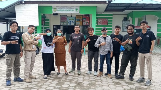
Dokumentasi: tim menyiapkan drone dan memeriksa kontrol sebelum penerbangan di Kelurahan Kamoro Jaya, Timika.

Dokumentasi: peserta bersiap menerbangkan drone di Kelurahan Kamoro Jaya, Timika.

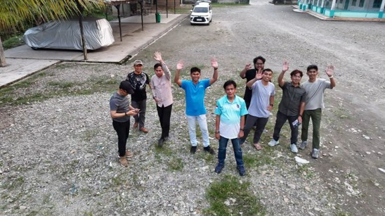
Dokumentasi: foto udara yang diambil dengan drone bersama peserta kegiatan di Kelurahan Kamoro Jaya, Timika.
Tags:
Tags: