Posted By

About Us
Lorem ipsum dolor sit amet, consectetur elit, sed do eiusmod tempor incididunt ut labore et magna aliqua.
Get a free quote
Strengthening Spatial Analysis Capacity in Health Research through QGIS and R Training
-

-
Published on
July 02, 2026
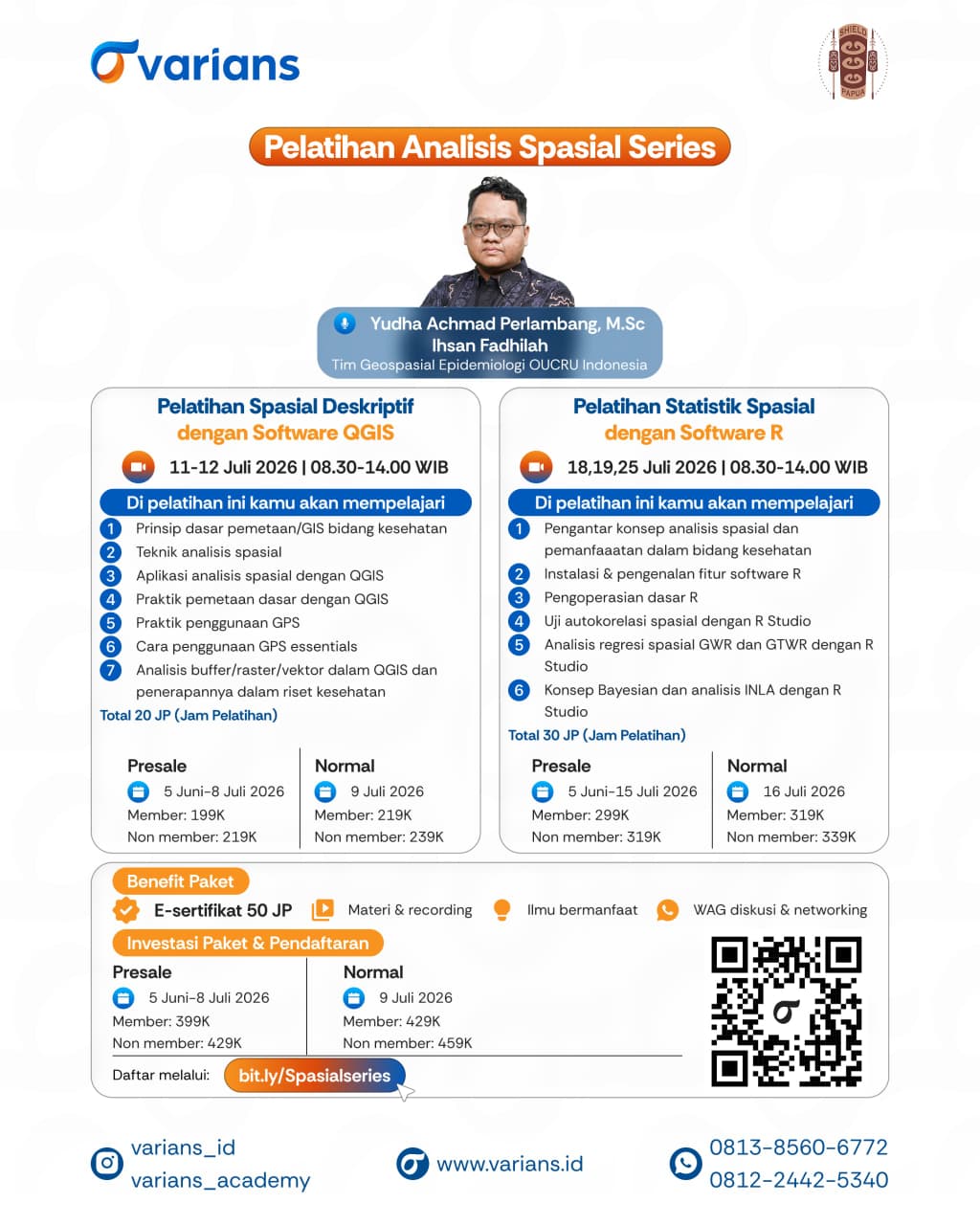
To strengthen researchers' capacity to manage, analyse, and interpret geographical information in health research, Varians Academy organised the Spatial Analysis Series, comprising two specialised training courses: Descriptive Spatial Analysis Using QGIS on 11–12 July 2026 and Spatial Statistics Using R on 18, 19, and 25 July 2026. Both courses were delivered online from 8:30 am to 2:00 pm (WIB) and were open to researchers, academics, students, and practitioners from a wide range of institutions.
The training was facilitated by Yudha Achmad Perlambang, M.Sc. and Ihsan Fadillah from the Geospatial Epidemiology Team, Oxford University Clinical Research Unit (OUCRU) Indonesia. Drawing on their expertise in spatial epidemiology and public health research, the facilitators shared practical approaches to applying geospatial technologies to support health research, disease surveillance, and evidence-informed decision-making.
During the Descriptive Spatial Analysis Using QGIS course, participants explored the fundamentals of Geographic Information Systems (GIS), spatial analysis techniques, the use of QGIS software, basic mapping practices, GPS applications, and vector and raster data analysis for health research. Meanwhile, the Spatial Statistics Using R course introduced key concepts in spatial analysis for health, the fundamentals of the R programming environment, spatial autocorrelation analysis, spatial regression using Geographically Weighted Regression (GWR) and Geographically and Temporally Weighted Regression (GTWR), as well as an introduction to Bayesian analysis and Integrated Nested Laplace Approximation (INLA) using R.
In addition to developing technical competencies, the training highlighted the importance of selecting appropriate spatial analytical methods to improve the accuracy of research findings and to better understand the geographical distribution of diseases and their associated risk factors. These skills are increasingly valuable for epidemiological research, health programme evaluation, and the planning of location-specific public health interventions.
It is hoped that initiatives such as this will continue to provide a collaborative platform for researchers, academics, and practitioners to strengthen spatial analysis capacity in the health sector. By equipping participants with geospatial and spatial statistical skills, the programme aims to support the production of high-quality scientific evidence that can inform more effective, targeted, and evidence-based health policies and interventions.
Tags:
Tags: